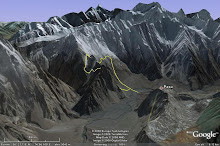
A few years ago Leicester University rationalised its storage space and returned archived undergraduate mapping projects to their owners. The project was to map an area 3 x 3 miles during 3 separate visist of 1 month each.
My project was in SW Strath, Isle of Skye and I visited during Summer 1972, Easter 1973 (it was cold) and Summer 1973. I used the 2nd class rail fare travel allowance and 1Pound B&B allowance to buy an ex-GPO Morris1000 van (post office red) and drove and camped.
The geology was fascinating (Red Hills granites and rhyolites to the north, Beinn An Dubhaich granite intruding Cambrian limestones in north-centre and Mesozoic sediments to the south, all intruded by Tertiary dyke swarms) and the task of recording and interpreting it was challenging but rewarding. It probably set some of my characteristics that have borne me well throughout my chequered career.
The mapping was caried by pace-and-compass using a 6" topographic map as a base. It would be fascinating to repeat the excercise after 30 years of field and office studies and using modern day GPS and digital map facilities. Perhaps one day!
Geeky Geo Links
Geodirect Field Studies
- 2010 Wadi's Degla & Hitan, Jebel El Zeit, Egypt
- 2008 Namibian Palaeogeography
- 2007 Uluru Earthcache Central Australia
- 2007 Glossifungites Lviv Ukraine Earthcache
- 2006 Romanian Carpathian
- 2006 Cesky Raj Sedimentology Czech Republic
- 2006 Bavarian ForeAlp S Germany
- 2005 Pishin Basin Margin Reconnaisance Pakistan/Afghanistan
- 2004 North West Frontier Province Salajit expedition Pakistan
- 2000 Sequence Stratigraphy Nammal Gorge, Pakistan, (Bilal Haq)
- 1999 Brushy Canyon Turbidtes Delaware USA
- 1997 Jal Al -Zor Escarpment Excursions, Kuwait (Carman)
- 1997 Al Mutla, Kuwait
- 1996 Modern oolite beaches, Kuwait (Lomando)
- 1996 Jebel Akhdar Oman (tourist)
- 1995 Kuwait oil seep searching and sampling (Burgan and Bahrah)
- 1991 APPEA Gippsland Basin excursion
- 1990 Vailala Lamari Divide Recconaisance PNG
- 1990 Tauri Traverse PNG
- 1990 Pale Sandtone Sedimentological Survey PNG
- 1990 Ormo AnticlineTraverses PNG
- 1990 Aure Scarp Field Excursion/First PNG Convention
- 1990 APPEA Amadeus Basin Excursion
- 1989 Kurai Gravity Survey, PNG
- 1989 Eri Antincline Geol Survey, PNG
- 1988 Simbari Gravity Survey, PNG
- 1988 Saw Mountains Geol Survey, PNG
- 1988 GSPNG Regional Recconnaisance Seminar, PNG
- 1987 Crater Mountain Geol Survey, PNG
- 1986 M'Bwei Aure Scarp Geol Survey, PNG
- 1986 Hells Gate Port Moresby Geol Survey, PNG
- 1986 Aure Scarp First Ascent, PNG
- 1983-1993 Papua New Guinea - Extensive
- 1983 Vailala Seismic Lines Geological recce
- 1982 Yanneia Vailala Geological Survey
- 1975 S Muller Range & Olsobip Oksapmin Surveys PNG
- 1974 NW Scotland Structural Tour Dr B Windley
- 1973 Sicily Field Studies, Italy
- 1973 Heimay Volcanic Studies Iceland
- 1972 SW Strath Isle of Skye Under grad mapping
- 1972 Anglesey Wales
- 1970 Blaustein Quarry S Germany
- 1969 Trimmingham Cliffs
- 1968 Island of Hoy My first geology survey
- 1968 Hunstanton cliffs
Other Links
Saturday, May 21, 2011
Isle of Skye 1972-74
Labels:
Mapping the Skye


